
Athens topographic map
Interactive map
Click on the map to display elevation.
About this map
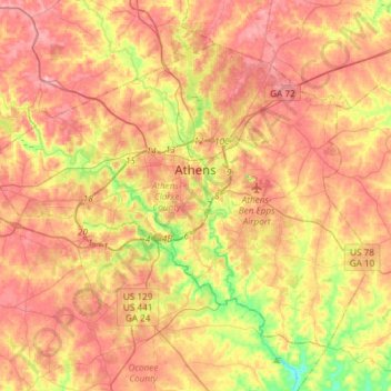
Name: Athens topographic map, elevation, terrain.
Location: Athens, Clarke County, Georgia, United States (33.84802 -83.53747 34.03947 -83.24083)
Average elevation: 219 m
Minimum elevation: 142 m
Maximum elevation: 276 m
Other topographic maps
Click on a map to view its topography, its elevation and its terrain.