
Hohenwald topographic map
Interactive map
Click on the map to display elevation.
About this map
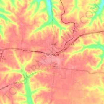
Name: Hohenwald topographic map, elevation, terrain.
Location: Hohenwald, Lewis County, Tennessee, United States (35.53050 -87.59935 35.56888 -87.50690)
Average elevation: 278 m
Minimum elevation: 211 m
Maximum elevation: 305 m
Other topographic maps
Click on a map to view its topography, its elevation and its terrain.
The Farm
United States > Tennessee > Lewis County
The Farm, Lewis County, Tennessee, United States
Average elevation: 288 m