
King's Weir topographic map
Interactive map
Click on the map to display elevation.
About this map
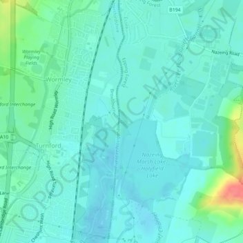
Name: King's Weir topographic map, elevation, terrain.
Average elevation: 28 m
Minimum elevation: 16 m
Maximum elevation: 80 m
England trails, hiking, mountain biking, running and outdoor activities
Other topographic maps
Click on a map to view its topography, its elevation and its terrain.
Waltham Abbey
United Kingdom > England > Epping Forest
The River Lea, which forms the county boundary with Hertfordshire, is the town's western boundary, and the eastern boundary runs through Epping Forest. The land rises gradually from the marshes and meadows by the river to a small plateau of london clay in the east, 60–90 metres above sea level, capped in the…
Average elevation: 44 m
Epping Upland
United Kingdom > England > Epping Forest > Epping Green > Epping Upland
Average elevation: 82 m