
Burke County topographic map
Interactive map
Click on the map to display elevation.
About this map
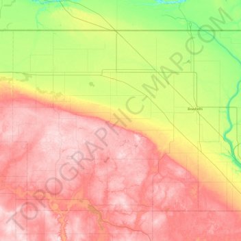
Name: Burke County topographic map, elevation, terrain.
Location: Burke County, North Dakota, United States (48.54562 -102.94001 48.99933 -102.02287)
Average elevation: 645 m
Minimum elevation: 517 m
Maximum elevation: 769 m
Other topographic maps
Click on a map to view its topography, its elevation and its terrain.
North Salt Lake State Game Management Area
United States > North Dakota > Walsh County
Average elevation: 251 m