
Thank you for supporting this site ❤️
Make a donation
Make a donation
Gear up for your next adventure:
As an Amazon Associate, this site earns from qualifying purchases at no extra cost to you.
本田三丁目 topographic map
Click on the map to display elevation.
Thank you for supporting this site ❤️
Make a donation
Make a donation
Gear up for your next adventure:
As an Amazon Associate, this site earns from qualifying purchases at no extra cost to you.
About this map
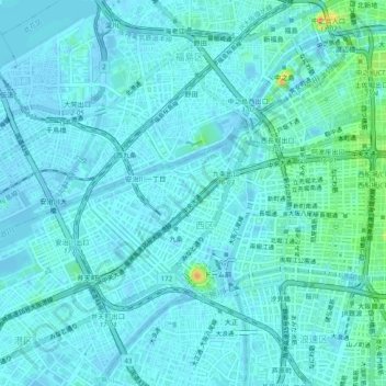
Name: 本田三丁目 topographic map, elevation, terrain.
Location: 本田三丁目, Nishi Ward, Osaka, Osaka Prefecture, 〒550-0027, Japan (34.65785 135.45536 34.69785 135.49536)
Average elevation: 5 m
Minimum elevation: -3 m
Maximum elevation: 34 m
Thank you for supporting this site ❤️
Make a donation
Make a donation
Gear up for your next adventure:
As an Amazon Associate, this site earns from qualifying purchases at no extra cost to you.