
Cheyenne topographic map
Interactive map
Click on the map to display elevation.
Cheyenne
The Cheyenne Regional Airport was opened in 1920, initially serving as a stop for airmail. It soon developed into a civil-military airport, serving DC-3s and various military craft. During World War II, hundreds of B-17s, B-24s, and PBYs were outfitted and upgraded at the airfield. Today, it serves a number of military functions, and as a high-altitude testbed for civilian craft.[16]
About this map
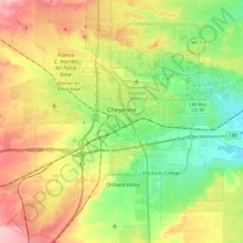
Name: Cheyenne topographic map, elevation, terrain.
Location: Cheyenne, Laramie County, Wyoming, United States (41.07310 -104.86112 41.19303 -104.67493)
Average elevation: 1,871 m
Minimum elevation: 1,803 m
Maximum elevation: 1,962 m
Other topographic maps
Click on a map to view its topography, its elevation and its terrain.