
Make a donation
Gear up for your next adventure:
As an Amazon Associate, this site earns from qualifying purchases at no extra cost to you.
Jericho topographic map
Click on the map to display elevation.
Make a donation
Gear up for your next adventure:
As an Amazon Associate, this site earns from qualifying purchases at no extra cost to you.
About this map
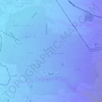
Name: Jericho topographic map, elevation, terrain.
Location: Jericho, Area A, West Bank, Palestinian Territory (31.84639 35.43413 31.88361 35.48281)
Average elevation: -244 m
Minimum elevation: -295 m
Maximum elevation: -141 m
Make a donation
Gear up for your next adventure:
As an Amazon Associate, this site earns from qualifying purchases at no extra cost to you.
Other topographic maps
Click on a map to view its topography, its elevation and its terrain.
Sanur
Palestinian Territory > Area A
Sanur is located in the highlands of the northern West Bank. The village is situated on an isolated hilltop along the western edge of the valley and seasonal lake of Marj Sanur, which is named after the village. To the west, Sanur is connected to the Hawarah Ridge of the Zawiya Highlands through a low-lying…
Average elevation: 423 m
Make a donation
Gear up for your next adventure:
As an Amazon Associate, this site earns from qualifying purchases at no extra cost to you.
Nablus
Palestinian Territory > Area A
Insofar as the hilly topography of the site would allow, the city was built on a Roman grid plan and settled with veterans who fought in the victorious legions and other foreign colonists. In the 2nd century CE, Emperor Hadrian built a grand theater in Neapolis that could seat up to 7,000 people. Coins found…
Average elevation: 645 m
Make a donation
Gear up for your next adventure:
As an Amazon Associate, this site earns from qualifying purchases at no extra cost to you.
Make a donation
Gear up for your next adventure:
As an Amazon Associate, this site earns from qualifying purchases at no extra cost to you.
Meithalun
Palestinian Territory > Area A > Meithalun
The town is situated along the western edge of Marj Sanur, a valley and seasonal lake. It is the largest locality, of seven total, bordering Marj Sanur and controls the largest share of its fertile lands. It has an average elevation of 385 meters above sea level and is not elevated from its immediate…
Average elevation: 403 m