
Kainuk topographic map
Interactive map
Click on the map to display elevation.
About this map
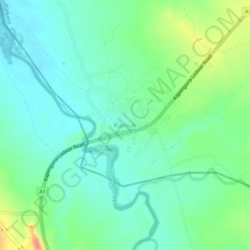
Name: Kainuk topographic map, elevation, terrain.
Location: Kainuk, Turkana County, Kenya (1.75464 35.48302 1.79464 35.52302)
Average elevation: 824 m
Minimum elevation: 803 m
Maximum elevation: 877 m
Other topographic maps
Click on a map to view its topography, its elevation and its terrain.
Kangakipur
Kenya > Turkana County > Kangakipur
Kangakipur, Turkana County, Kenya
Average elevation: 697 m