
Hughes Spring topographic map
Click on the map to display elevation.
About this map
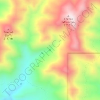
Name: Hughes Spring topographic map, elevation, terrain.
Average elevation: 1,977 m
Minimum elevation: 1,673 m
Maximum elevation: 2,278 m
Other topographic maps
Click on a map to view its topography, its elevation and its terrain.
Phoenix
United States > Arizona > Maricopa County
Phoenix is characterized by a unique topographical landscape nestled in the Salt River Valley. This valley, at an average elevation of about 1,086 feet, is framed by several prominent mountain ranges, creating a striking contrast between the flat plains and elevated terrains. Notable peaks such as Camelback…
Average elevation: 481 m
Phoenix
United States > Arizona > Maricopa County
Phoenix is in the southwestern United States, in the south-central portion of Arizona; about halfway between Tucson to the southeast and Flagstaff to the north. By car, the city is approximately 150 miles (240 kilometers) north of the US-Mexico border at Sonoyta and 180 mi (290 km) north of the border at…
Average elevation: 481 m
Tucson
United States > Arizona > Pima County
Tucson is situated on an alluvial plain in the Sonoran Desert, at an elevation of approximately 2,400 feet (730 meters) above sea level. The city is enveloped by five mountain ranges, which contribute significantly to its varied topography. To the north lie the Santa Catalina and Tortolita Mountains, while the…
Average elevation: 822 m
Tucson
United States > Arizona > Pima County
By 1900, 7,531 people lived in Tucson. By 1910, the population increased to 13,913. At about this time, the U.S. Veterans Administration had begun construction of the present Veterans Hospital. The city's clean, dry air made it a destination for the many veterans who had been gassed in World War I and needed…
Average elevation: 822 m
Scottsdale
United States > Arizona > Maricopa County
Scottsdale features a diverse topography shaped by its location within the Sonoran Desert and the foothills of the McDowell Mountains. The city sits at an average elevation of about 1,827 feet (558 meters), with a range that spans from approximately 1,052 feet (321 meters) at its lowest points to 4,819 feet…
Average elevation: 553 m
Grand Canyon National Park
The North Rim area of the park is located on the Kaibab Plateau and Walhalla Plateau, directly across the Grand Canyon from the principal visitor areas on the South Rim. The North Rim's principal visitor areas are centered around Bright Angel Point. The North Rim is higher in elevation than the South Rim, at…
Average elevation: 1,685 m
Grand Canyon National Park
The topography of Grand Canyon National Park is defined by dramatic elevations and striking geological features. The park, located in Mohave County, Arizona, encompasses over 278 miles of the Colorado River and its surrounding plateaus. The canyon itself reaches depths of more than a mile (6,000 feet) from rim…
Average elevation: 1,685 m
Prescott
United States > Arizona > Yavapai County
Prescott is in the Bradshaw Mountains of central Arizona, at an elevation of 5,400 feet (1,600 m). The city has a Mediterranean climate (Köppen Csa); however, unlike most other locations in this climate class, there is a pronounced summer wet season due to the North American Monsoon.
Average elevation: 1,674 m
Payson
United States > Arizona > Gila County
Located in northern Gila County at an elevation of 5,000 feet (1,500 m), the town has a total area of 19.5 square miles (51 km2). The Mogollon Rim, the southern boundary of the Colorado Plateau, lies to the north of Payson, with elevations exceeding 7,500 feet (2,300 m); there are many cold water lakes on top…
Average elevation: 1,522 m
Williams
United States > Arizona > Coconino County
Williams occupies a high, forested setting in northern Arizona, in the heart of the Kaibab National Forest at about 6,770 feet (2,063 m) above sea level, where broad plateau surfaces, shallow drainage corridors, and low volcanic hills give the town a gently undulating upland character. Its most prominent…
Average elevation: 2,131 m
Cave Creek
United States > Arizona > Maricopa County
Cave Creek is a town in the Sonoran Desert. It sits in northern Maricopa County on the northern edge of Paradise Valley, with mountains rising to the north that eventually connect with the New River Mountains and the Black Hills. It is 33 miles (53 km) north of downtown Phoenix, although the Phoenix city…
Average elevation: 743 m
Show Low
United States > Arizona > Navajo County
Show Low is a city in Navajo County, Arizona. It lies on the Mogollon Rim in east central Arizona, at an elevation of 6,345 feet (1,934 m). The city was established in 1870 and incorporated in 1953. According to the 2010 census, the population of the city was 10,660.
Average elevation: 1,957 m
Heber-Overgaard
United States > Arizona > Navajo County
Heber-Overgaard is a census-designated place (CDP) in Navajo County, Arizona, United States. Situated atop the Mogollon Rim, the community lies at an elevation of 6,627 feet (2,020 m). The population was 2,898 at the 2020 census. Heber and Overgaard are technically two unincorporated communities, but as of the…
Average elevation: 2,015 m
Maricopa
United States > Arizona > Pinal County
The topography in Maricopa is flat, with several mountain ranges 10 to 20 miles away. The elevation of Maricopa is 1190 feet.
Average elevation: 369 m
Gilbert
United States > Arizona > Maricopa County
Gilbert is characterized by a relatively flat terrain typical of the Sonoran Desert region. The town sits at an elevation of approximately 1,237 feet (377 meters) above sea level, with minor fluctuations in topography across its 68.86 square miles. The landscape primarily features arid desert terrain, dotted…
Average elevation: 383 m
Sierra Vista
United States > Arizona > Cochise County
Sierra Vista occupies a broad high-desert basin in southeastern Arizona, set at about 4,623 feet (1,409 m) above sea level at the foot of the Huachuca Mountains, where the terrain shifts sharply from open valley floors to rugged “sky island” relief. The city lies within the Upper San Pedro Basin, with the…
Average elevation: 1,513 m
Jerome
United States > Arizona > Yavapai County
Jerome is about 100 miles (160 km) north of Phoenix and 45 miles (72 km) southwest of Flagstaff along Arizona State Route 89A between Sedona to the east and Prescott to the west. The town is in Arizona's Black Hills, which trend north–south. The town lies within the Prescott National Forest at an elevation…
Average elevation: 1,574 m
Payson
United States > Arizona > Gila County
Located in northern Gila County at an elevation of 5,000 feet (1,500 m), the town has a total area of 19.5 square miles (51 km2). The Mogollon Rim, the southern boundary of the Colorado Plateau, lies to the north of Payson, with elevations exceeding 7,500 feet (2,300 m); there are many cold water lakes on top…
Average elevation: 1,522 m
Peoria
United States > Arizona > Maricopa County
Peoria, located in Maricopa County, Arizona, is set within the expansive Salt River Valley. The city's terrain is generally flat, with an average elevation of around 1,122 feet (342 meters) above sea level. However, as you move northward, the landscape gradually transitions into the foothills of the…
Average elevation: 505 m
Yavapai County
The county's topography makes a dramatic transition from the lower Sonoran Desert to the south to the heights of the Coconino Plateau to the north, and the Mogollon Rim to the east. The highest point above sea level (MSL) in Yavapai County is Mount Union at an elevation of 7,979 ft (2,432 m) and the lowest is…
Average elevation: 1,433 m
Fountain Hills
United States > Arizona > Maricopa County
Fountain Hills is in eastern Maricopa County, on the eastern edge of the Phoenix urbanized area. It is 31 miles (50 km) northeast of downtown Phoenix and sits on the east side of the south end of the McDowell Mountains. According to the U.S. Census Bureau, the town has a total area of 20.4 square miles (53…
Average elevation: 503 m
Tonto National Forest
The Tonto National Forest, encompassing 2,873,200 acres (1,162,700 ha; 11,627 km2), is the largest of the six national forests in Arizona and is the ninth largest national forest in the United States. The forest has diverse scenery, with elevations ranging from 1,400 feet (427 m) in the Sonoran Desert to 7,400…
Average elevation: 1,177 m
Fort Apache Indian Reservation
The Fort Apache Indian Reservation is covered mostly by pine forests and is habitat to a variety of forest wildlife. It is located directly south of the Mogollon Rim. The highest point in the reservation is Baldy Peak, with an elevation of 11,403 feet (3,476 m).
Average elevation: 1,862 m
Nogales
United States > Arizona > Santa Cruz County
The city is at an elevation of 3,829 feet (1,167 m).
Average elevation: 1,192 m
Tempe
United States > Arizona > Maricopa County
Tempe is generally flat, except for Tempe Butte or Hayden Butte (generally known as A-Mountain for Arizona State University's "A" logo located on its south face), located next to Sun Devil Stadium, Twin Buttes and Bell Butte on the western edge of Tempe, and the buttes within Papago Park at northwest corner of…
Average elevation: 370 m
Bullhead City
United States > Arizona > Mohave County
Hardyville Pioneer Cemetery, a small cemetery, now a historic landmark at 35°7′16″N 114°35′17″W / 35.12111°N 114.58806°W / 35.12111; -114.58806, is the most significant existing remnant of Hardyville. An unofficial historical marker for the town is in the parking lot across Highway 95 from…
Average elevation: 328 m
Prescott
United States > Arizona > Yavapai County
Prescott is in the Bradshaw Mountains of central Arizona, at an elevation of 5,400 feet (1,600 m). The city has a Mediterranean climate (Köppen Csa) bordering on a Humid subtropical climate (Köppen Cwa); however, unlike most other locations in this climate class, there is a pronounced summer wet season due…
Average elevation: 1,674 m
Sedona
United States > Arizona > Coconino County
Sedona interior chaparral has many shrubs and small tree species of Quercus turbinella and Rhus ovata and a large population of Quercus palmeri. The Great Basin woodland has many small to medium trees of Pinus monophylla Var. fallax, Juniperus arizonica, Juniperus deppeana, Juniperus osteosperma, and Juniperus…
Average elevation: 1,496 m
Pine
United States > Arizona > Gila County > Pine
Pine and the adjacent community of Strawberry are rapidly growing vacation and retirement centers in north-central Arizona, below the Mogollon Rim. Pine's elevation is 5,448 feet (1,661 m), and the Pine post office was established in 1884.
Average elevation: 1,794 m
Safford
United States > Arizona > Graham County
The climate is cold semi-arid (Köppen: BSk) softened by the plateau rise (it receives enough rainfall not to fall into a cold desert, BWk). It is much hotter than most places in eastern Arizona due to its relatively low elevation of 2,953 feet (900 m) at the Agricultural Center where records are kept, and…
Average elevation: 912 m
Page
United States > Arizona > Coconino County
Unlike other cities in the area, Page was founded in 1957 as a housing community for workers and their families during the construction of nearby Glen Canyon Dam on the Colorado River. Its 17-square-mile (44 km2) site was obtained in a land exchange with the Navajo Nation. The city is perched atop Manson Mesa…
Average elevation: 1,225 m
Globe
United States > Arizona > Gila County
Globe has a semi-arid climate, characterized by hot summers and moderate to warm winters. Globe's arid climate is somewhat tempered by its elevation, however, leading to slightly cooler temperatures and slightly more precipitation than Phoenix or Yuma.
Average elevation: 1,173 m
Window Rock
United States > Arizona > Apache County
Window Rock is categorized as being within the 6a USDA hardiness zone, meaning the average annual extreme minimum temperature is between −10 and −5 °F (−23 and −21 °C). The city is cooler than most of Arizona due to its high elevation.
Average elevation: 2,084 m
Arizona City
United States > Arizona > Pinal County > Arizona City
Arizona City itself is mostly flat, lying in the Santa Cruz Valley in the center of three low mountain ranges; the Sawtooth Mountains to the south, the Picacho Mountains to the east, and the Casa Grande Mountains to the north. Picacho Peak, a prominent peak with a summit elevation of 3,374 feet (1,028 m), is…
Average elevation: 459 m
Oro Valley
United States > Arizona > Pima County
Oro Valley is located at 32°25′N 110°59′W / 32.417°N 110.983°W / 32.417; -110.983 (32.4212, −110.9760) in the middle Cañada del Oro Valley. Oro Valley sits at an average elevation of 2,620 feet (800 m) above sea level.
Average elevation: 969 m
Saguaro National Park
United States > Arizona > Pima County
Both districts conserve tracts of the Sonoran Desert, including ranges of significant hills, the Tucson Mountains in the west and the Rincon Mountains in the east. Elevations in the Tucson Mountain District range from 2,180 to 4,687 feet (664 to 1,429 m), the summit of Wasson Peak. Elevations within the Rincon…
Average elevation: 1,174 m