
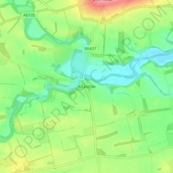
Allanton topographic map
Interactive map
Click on the map to display elevation.
About this map
Name: Allanton topographic map, elevation, terrain.
Location: Allanton, Scottish Borders, Scotland, TD11 3JZ, United Kingdom (55.76192 -2.23585 55.80192 -2.19585)
Average elevation: 64 m
Minimum elevation: 29 m
Maximum elevation: 124 m
Scottish Borders trails, hiking, mountain biking, running and outdoor activities
Other topographic maps
Click on a map to view its topography, its elevation and its terrain.
Greenknowe Tower
United Kingdom > Scotland > Scottish Borders > Gordon > Nether Huntlywood
Average elevation: 157 m
Curling Pond
United Kingdom > Scotland > Scottish Borders > Earlston > Georgefield
Average elevation: 153 m