
Ludewa topographic map
Interactive map
Click on the map to display elevation.
About this map
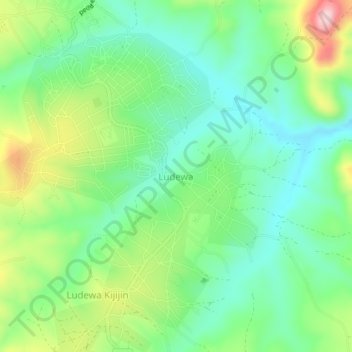
Name: Ludewa topographic map, elevation, terrain.
Location: Ludewa, Njombe Region, Southern Highlands Zone, Tanzania (-10.12665 34.67231 -10.08665 34.71231)
Average elevation: 1,324 m
Minimum elevation: 1,245 m
Maximum elevation: 1,482 m
Other topographic maps
Click on a map to view its topography, its elevation and its terrain.
Kinenulo
Kinenulo, Wanging'ombe, Njombe Region, Southern Highlands Zone, Tanzania
Average elevation: 1,986 m
Ugabwa
Ugabwa, Makete, Njombe Region, Southern Highlands Zone, Tanzania
Average elevation: 2,283 m
Kitulo National Park
Kitulo National Park, Makete, Njombe Region, Southern Highlands Zone, Tanzania
Average elevation: 2,397 m
Lupembe
Tanzania > Njombe Region > Lupembe
Lupembe, Njombe, Njombe Region, Southern Highlands Zone, Tanzania
Average elevation: 1,574 m