
Turda topographic map
Interactive map
Click on the map to display elevation.
About this map
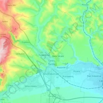
Name: Turda topographic map, elevation, terrain.
Location: Turda, Cluj, Romania (46.51912 23.71778 46.64897 23.88614)
Average elevation: 398 m
Minimum elevation: 301 m
Maximum elevation: 726 m
Other topographic maps
Click on a map to view its topography, its elevation and its terrain.