
Massingir topographic map
Interactive map
Click on the map to display elevation.
About this map
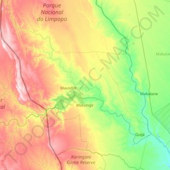
Name: Massingir topographic map, elevation, terrain.
Location: Massingir, Gaza Province, Mozambique (-24.34799 31.55073 -23.22693 32.63990)
Average elevation: 187 m
Minimum elevation: 37 m
Maximum elevation: 496 m
Other topographic maps
Click on a map to view its topography, its elevation and its terrain.