Geolocate

Pasir Gudang topographic maps

Click on a map to view its topography, its elevation and its terrain.

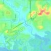
Kim Kim River

Malaysia > Johor > Pasir Gudang

Average elevation: 24 m

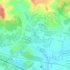
Sungai Kim Kim

Malaysia > Johor > Pasir Gudang

Average elevation: 15 m

Sungai Masai

Malaysia > Johor > Pasir Gudang

Average elevation: 36 m

Johor River

Malaysia > Johor > Pasir Gudang

Average elevation: 19 m

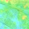
Sungai Kim Kim

Malaysia > Johor > Pasir Gudang

Average elevation: 14 m

Bayan Park

Malaysia > Johor > Pasir Gudang

Average elevation: 23 m

Kampung Perigi Acheh

Malaysia > Johor > Pasir Gudang

Average elevation: 4 m

Kampung Kopok Baru

Malaysia > Johor > Pasir Gudang

Average elevation: 28 m

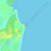
Juling Island

Malaysia > Johor > Pasir Gudang

Average elevation: 2 m

Sungai Latoh

Malaysia > Johor > Pasir Gudang

Average elevation: 15 m

About this place

Gear up for your next adventure:

🧺Ultralight Dry Bags - Organize and waterproof your gear inside your rucksack
⛺Camping Shelters - Emergency and lightweight shelters for outdoor use
💧Hydration Reservoirs - Convenient water bladders for hands-free drinking on the move
🚶Walking Pedometers - Simple distance tracking for casual trail walkers
🦟Anti-Midge & Tick Repellent - Vital for hiking in the Scottish Highlands during summer

As an Amazon Associate, this site earns from qualifying purchases at no extra cost to you.