Geolocate

Chard topographic maps

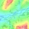
Click on a map to view its topography, its elevation and its terrain.

Forde Abbey

United Kingdom > England > Dorset > Chard > Forde Abbey

Average elevation: 100 m

About this place

Gear up for your next adventure:

🧊Personal Water Filters - Drink safely from mountain streams marked on your map
🧢Waterproof Hiking Hats - Keep the rain off your face while studying topographic maps
🗺️Scratch-off Peak Maps - Track your progress climbing Munros or Wainwrights
🥤Hydration Bladders - Hands-free hydration systems for backpacks
🚲Bikepacking Frame Bags - Storage for tools and navigation gear on long off-road rides

As an Amazon Associate, this site earns from qualifying purchases at no extra cost to you.