Geolocate

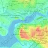
Halton topographic maps

Click on a map to view its topography, its elevation and its terrain.

Widnes

United Kingdom > England > Halton

Average elevation: 24 m

Runcorn

United Kingdom > England > Halton

Average elevation: 22 m

Weston

United Kingdom > England > Halton > Runcorn

Average elevation: 27 m

Preston on the Hill

United Kingdom > England > Halton

Average elevation: 50 m

Oxmoor Wood

United Kingdom > England > Halton > Runcorn

Average elevation: 12 m

Hale

United Kingdom > England > Halton

Average elevation: 7 m

Ditton Brook

United Kingdom > England > Halton > Widnes

Average elevation: 15 m

Daresbury

United Kingdom > England > Halton

Average elevation: 50 m

Widnes

United Kingdom > England > Halton

Average elevation: 24 m

Runcorn

United Kingdom > England > Halton

Average elevation: 21 m

About this place

 •  •

Gear up for your next adventure:

🛰️Handheld GPS Devices - Reliable GPS units for hiking and outdoor navigation
🧷Tenacious Repair Tape - Instant fix for torn tents, jackets, or dry bags
📐Altimeters & Barometers - Tools for measuring altitude and air pressure
🧣Neck Gaiters - Versatile protection against wind and cold
🥫Expedition Meals - Lightweight, high-calorie nutrition for long-distance hikers

As an Amazon Associate, this site earns from qualifying purchases at no extra cost to you.