Geolocate

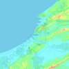
Bintulu topographic maps

Click on a map to view its topography, its elevation and its terrain.

Kampung Kuala Nyalau

Malaysia > Sarawak > Bintulu

Average elevation: 11 m

RH. Sulong

Malaysia > Sarawak > Bintulu

Average elevation: 35 m

Bintulu

Malaysia > Sarawak > Bintulu

Average elevation: 18 m

Similajau National Park

Malaysia > Sarawak > Bintulu

Average elevation: 29 m

Gear up for your next adventure:

🥤Collapsible Water Bottles - Save space in your rucksack as you consume your water
🔦Keychain LED Torches - Emergency backup light for finding gear in your pack
🎒Hiking Backpacks - Comfortable backpacks for day hikes and multi-day treks
🗺️Ordnance Survey Maps - Official UK maps for walking and outdoor activities
🧢Waterproof Hiking Hats - Keep the rain off your face while studying topographic maps

As an Amazon Associate, this site earns from qualifying purchases at no extra cost to you.