Hawaii topographic maps
Click on a map to view its topography, its elevation and its terrain.

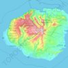
Kauai
United States > Hawaii > Kauaʻi County
Kauai, known as the "Garden Isle," features a remarkably diverse topography shaped by its volcanic origins and extensive erosion over millions of years. The island is characterized by a central mountainous region, dominated by the towering 5,148-foot Mount Waiʻaleʻale, one of the wettest places on Earth, and…
Average elevation: 216 m
Pearl Harbor National Memorial
United States > Hawaii > Honolulu County > Waipahu
Average elevation: 9 m


Waimānalo Beach Park
United States > Hawaii > Honolulu County > East Honolulu > Waimanalo
Average elevation: 55 m



Hawaiian Ocean View
United States > Hawaii > Hawaiʻi County
The HOVE development consisted of 10,697 1-acre (4,000 m2) lots north of the Hawaii Belt Road in the western part of the District of Kaʻū. The terrain varies from rugged lava fields to ohiʻa trees and other vegetation. Elevation ranges from about 1,500 ft (460 m) up to the 5,000-foot (1,500 m) level.…
Average elevation: 723 m










Molokini Shoal Marine Life Conservation District
United States > Hawaii > Maui County
Average elevation: 0 m





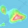
Maui
United States > Hawaii > Maui County
Maui's diverse landscapes are the result of a unique combination of geology, topography, and climate. Each volcanic cone in the chain of the Hawaiian Islands is built of dark, iron-rich/quartz-poor rocks, which poured out of thousands of vents as highly fluid lava throughout millions of years. Several of the…
Average elevation: 232 m

Hawaiian Islands
The Hawaiian Islands are tropical but experience many different climates, depending on altitude and surroundings. The islands receive most rainfall from the trade winds on their north and east flanks (the windward side) as a result of orographic precipitation. Coastal areas in general and especially the south…
Average elevation: 2 m


Haleakalā National Park
United States > Hawaii > Maui County
At its lowest, near the ocean, the National Park has a tropical rainforest climate bordering a tropical monsoon climate. However, as altitudes progresses the climate becomes oceanic/Mediterranean, reaching, at the very top of Haleakalā, an alpine climate.
Average elevation: 949 m
Waimea/Kamuela
United States > Hawaii > Hawaiʻi County
Waimea is located in the northern part of the island of Hawaii at 20°1′26″N 155°38′50″W / 20.02389°N 155.64722°W / 20.02389; -155.64722 (20.023926, -155.647357), at an elevation of 2,676 feet (816 m) above sea level. It sits at the southern foot of Kohala, the oldest volcano on the island,…
Average elevation: 876 m

Mauna Loa
United States > Hawaii > Hawaiʻi County
Mauna Loa is the largest subaerial and second largest overall volcano in the world (behind Tamu Massif), covering a land area of 5,271 km2 (2,035 sq mi) and spans a maximum width of 120 km (75 mi). Consisting of approximately 65,000 to 80,000 km3 (15,600 to 19,200 cu mi) of solid rock, it makes up more than…
Average elevation: 4,037 m


Niihau
United States > Hawaii > Kauaʻi County > Puuwai
Niʻihau is located about 18 miles (29 km) west of Kauaʻi, and the tiny, uninhabited island of Lehua lies 0.7 miles (0.61 nmi; 1.1 km) north of Niʻihau. Niʻihau's dimensions are 6.2 miles by 18.6 miles (10 km × 30 km). The maximum elevation (Paniau) is 1,280 feet (390 m). The island is about 6 million…
Average elevation: 23 m

Molokai
United States > Hawaii > Maui County
The eastern half of the island is a high plateau rising up to an elevation of 4,900 ft (1,500 m) on Kamakou peak and includes the 2,774 acres (11.23 km2; 4.334 sq mi) Molokai Forest Reserve. The eastern half is covered with lush wet forests that get more than 300 in (7,600 mm) of rain per year. The…
Average elevation: 66 m