Geolocate

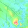
Shtip topographic maps

Click on a map to view its topography, its elevation and its terrain.

Zheleznichka

North Macedonia > Eastern Region > Shtip

Average elevation: 296 m

Gear up for your next adventure:

🗺️Topographic Maps - Detailed maps showing elevation and terrain features
🧥Softshell Jackets - Breathable jackets for active outdoor use
🪓Outdoor Multitools - Versatile tools for hiking and camping
🧣Fleece Neck Warmers - Extra insulation for winter topographic surveys
🧤Thermal Touchscreen Gloves - Stay warm while operating your GPS or smartphone camera

As an Amazon Associate, this site earns from qualifying purchases at no extra cost to you.