Geolocate

Elmore County topographic maps

Click on a map to view its topography, its elevation and its terrain.
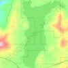
Featherville

United States > Idaho > Elmore County

Average elevation: 1,513 m

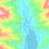
Pine

United States > Idaho > Elmore County

Average elevation: 1,462 m

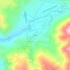
Atlanta

United States > Idaho > Elmore County

Average elevation: 1,820 m

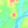
Sugar Bowl

United States > Idaho > Elmore County

Average elevation: 799 m

Mountain Home

United States > Idaho > Elmore County

Average elevation: 967 m

Gear up for your next adventure:

🔥Emergency Fire Starters - Reliable ignition tools for survival situations in damp conditions
🚶Walking Pedometers - Simple distance tracking for casual trail walkers
📦Dry Bags - Waterproof bags to protect gear from rain
🧭Professional Hiking Compasses - High-precision liquid-filled compasses for map reading and orientation
🧥Waterproof Hiking Jackets - Rain protection for walking in all weather conditions

As an Amazon Associate, this site earns from qualifying purchases at no extra cost to you.