Geolocate

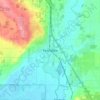
Ferndale topographic maps

Click on a map to view its topography, its elevation and its terrain.

Ferndale

United States > Washington > Whatcom County > Ferndale

Average elevation: 29 m

Gear up for your next adventure:

🍱Food Containers - Reusable containers for outdoor meals
🥼Base Layers - Thermal base layers for temperature regulation
🚲Cycling GPS Computers - Track elevation and topographic routes on two wheels
📱Phone Mounts for Hiking - Secure mounts to carry your phone on trails
🚶Walking Pedometers - Simple distance tracking for casual trail walkers

As an Amazon Associate, this site earns from qualifying purchases at no extra cost to you.