Geolocate

Jodhpur Tehsil topographic maps

Click on a map to view its topography, its elevation and its terrain.

Narwa Khichiyan

India > Rajasthan > Jodhpur Tehsil

Average elevation: 255 m

Surpura

India > Rajasthan > Jodhpur Tehsil

Average elevation: 232 m

Ranisar Talab

India > Rajasthan > Jodhpur Tehsil > Jodhpur

Average elevation: 282 m

Kayalana Lake

India > Rajasthan > Jodhpur Tehsil

Average elevation: 288 m

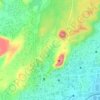
Jodhpur

India > Rajasthan > Jodhpur Tehsil

Average elevation: 238 m

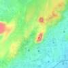
Mandore Garden

India > Rajasthan > Jodhpur Tehsil > Jodhpur

Average elevation: 263 m

About this place

 •

Gear up for your next adventure:

🍲Portable Camping Stoves - Fast-boiling stoves for hot meals on remote topographic survey trips
👖Packable Overtrousers - Quick-deploy rain protection for legs in sudden storms
📚UK Hiking Guidebooks - Detailed route descriptions for the Lake District, Peaks, and Highlands
🎒Hiking Daypacks - Compact backpacks ideal for short hikes and excursions
📱Rugged Phone Cases - Heavy-duty protection for smartphones used as secondary GPS tools

As an Amazon Associate, this site earns from qualifying purchases at no extra cost to you.