Geolocate

Bracknell Forest topographic maps

Click on a map to view its topography, its elevation and its terrain.

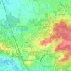
Cranbourne

United Kingdom > England > Bracknell Forest

Average elevation: 71 m

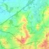
Chavey Down

United Kingdom > England > Bracknell Forest

Average elevation: 77 m

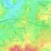
Nuptown

United Kingdom > England > Bracknell Forest

Average elevation: 58 m

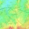
Winkfield

United Kingdom > England > Bracknell Forest

Average elevation: 73 m

Warfield

United Kingdom > England > Bracknell Forest

Average elevation: 64 m

Crowthorne

United Kingdom > England > Bracknell Forest

Average elevation: 82 m

Binfield

United Kingdom > England > Bracknell Forest

Average elevation: 58 m

Bracknell

United Kingdom > England > Bracknell Forest

Average elevation: 80 m

About this place

 •  •

Gear up for your next adventure:

🛰️Outdoor GPS Navigation - Navigation devices for remote and off-grid areas
🖼️Topographic Map Art - Decorative 3D-effect posters of famous UK peaks and regions
🚲Cycling GPS Computers - Track elevation and topographic routes on two wheels
🛌Sleeping Mats - Insulated mats for comfortable outdoor sleeping
🧥Softshell Jackets - Breathable jackets for active outdoor use

As an Amazon Associate, this site earns from qualifying purchases at no extra cost to you.