Geolocate

Peterborough topographic maps

Click on a map to view its topography, its elevation and its terrain.
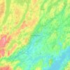
Peterborough

Canada > Ontario > Peterborough

Peterborough's topography is largely defined by land formations created by the receding Wisconsian glaciers 10,000–15,000 years ago. The South End and Downtown portions of the City sit on what was the bottom of the glacial Lake Peterborough—part of a glacial spillway created when glacial meltwaters from…

Average elevation: 235 m
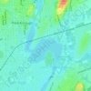
Little Lake

Canada > Ontario > Peterborough

Average elevation: 198 m

Wentworth Park

Canada > Ontario > Peterborough

Average elevation: 214 m

Otonabee River

Canada > Ontario > Peterborough

Average elevation: 197 m

Gear up for your next adventure:

🖼️Topographic Map Art - Decorative 3D-effect posters of famous UK peaks and regions
🎒Hiking Child Carriers - Explore the outdoors with the whole family safely
🥫Expedition Meals - Lightweight, high-calorie nutrition for long-distance hikers
🐕Dog Hiking Gear - Equipment for hiking safely with dogs
🛌Sleeping Bags - Warm and packable sleeping bags for outdoor nights

As an Amazon Associate, this site earns from qualifying purchases at no extra cost to you.