Geolocate

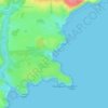
Stackpole topographic maps

Click on a map to view its topography, its elevation and its terrain.

Gear up for your next adventure:

👖Convertible Hiking Trousers - Versatile zip-off pants for changing mountain weather conditions
📐Altimeters & Barometers - Tools for measuring altitude and air pressure
🗺️Ordnance Survey Maps - Essential paper maps for hiking across the UK national parks
🧰Survival Kits - Emergency tools for remote environments
⛺Lightweight Tents - Compact tents for backpacking and trekking

As an Amazon Associate, this site earns from qualifying purchases at no extra cost to you.