Geolocate

Burdwan - I topographic maps

Click on a map to view its topography, its elevation and its terrain.
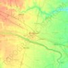
Bardhaman

India > West Bengal > Burdwan - I > Bardhaman

The region has an average elevation of 40 metres (131 ft). The city is situated 1100 km from New Delhi and a little less than 100 km north-west of Kolkata on the Grand Trunk Road (National Highway 19) and Eastern Railway. The chief rivers are the Damodar and the Banka.

Average elevation: 30 m

About this place

Gear up for your next adventure:

📻Hand-Crank Emergency Radios - Stay updated on weather warnings in remote areas
🔥Reusable Hand Warmers - Maintain dexterity in your fingers for precise map handling
🧵Survival Paracord - Multi-purpose cordage for emergency repairs and shelters
🔦Keychain LED Torches - Emergency backup light for finding gear in your pack
👕Technical Hiking Tees - Moisture-management for high-exertion climbs

As an Amazon Associate, this site earns from qualifying purchases at no extra cost to you.