Geolocate

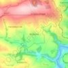
Metherell topographic maps

Click on a map to view its topography, its elevation and its terrain.

Metherell

United Kingdom > England > Cornwall > Metherell

Average elevation: 128 m

Gear up for your next adventure:

🧭Emergency Beacons - Safety beacons for remote outdoor locations
⛺Lightweight Tents - Compact tents for backpacking and trekking
🗺️Ordnance Survey Maps - Essential paper maps for hiking across the UK national parks
🧢Thermal Beanie Hats - Prevent heat loss from the head in windy summit conditions
🚲Cycling GPS Computers - Track elevation and topographic routes on two wheels

As an Amazon Associate, this site earns from qualifying purchases at no extra cost to you.