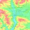
Click on a map to view its topography, its elevation and its terrain.
United Kingdom > England > Mid Devon > Crediton
Average elevation: 94 m
United Kingdom > England > Mid Devon > Willand
Average elevation: 73 m
United Kingdom > England > Mid Devon > Sampford Peverell
Average elevation: 108 m
United Kingdom > England > Mid Devon > Tiverton
Average elevation: 135 m
United Kingdom > England > Mid Devon > Chettiscombe
Average elevation: 117 m
United Kingdom > England > Mid Devon > Pennymoor
Average elevation: 200 m
As an Amazon Associate, this site earns from qualifying purchases at no extra cost to you.