Geolocate

Karachi South District topographic maps

Click on a map to view its topography, its elevation and its terrain.
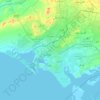
Karachi

Pakistan > Sindh > Karachi South District > Saddar Town

Karachi lies very close to a major fault line, where the Indian tectonic plate meets the Arabian tectonic plate. Within the city of Karachi are two small ranges: the Khasa Hills and Mulri Hills, which lie in the northwest and act as a barrier between North Nazimabad and Orangi. Karachi's hills are barren and…

Average elevation: 20 m

About this place

Gear up for your next adventure:

🧭Professional Hiking Compasses - High-precision liquid-filled compasses for map reading and orientation
👟Waterproof Leg Gaiters - Keep mud and water out of your boots in boggy terrain
🐕Hiking Dog Harnesses - Rugged harnesses for taking your companion on mountain trails
🗺️Scratch-off Peak Maps - Track your progress climbing Munros or Wainwrights
🧭Emergency Beacons - Safety beacons for remote outdoor locations

As an Amazon Associate, this site earns from qualifying purchases at no extra cost to you.