Geolocate

Memari - I topographic maps

Click on a map to view its topography, its elevation and its terrain.
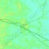
Memari

India > West Bengal > Memari - I

Memari is located at 23°12′N 88°07′E / 23.2°N 88.12°E / 23.2; 88.12. It has an average elevation of 25 metres (82 feet).

Average elevation: 21 m

Gear up for your next adventure:

🎒Hiking Child Carriers - Explore the outdoors with the whole family safely
☕Insulated Travel Mugs - Keep drinks hot while surveying the landscape from a summit
🔭Compact Hiking Binoculars - Lightweight optics for scouting terrain and spotting wildlife
🛰️Satellite Messengers - Emergency communication devices for areas without mobile signal
🎒Hiking Backpacks - Comfortable backpacks for day hikes and multi-day treks

As an Amazon Associate, this site earns from qualifying purchases at no extra cost to you.