Geolocate

Sungai Petani topographic maps

Click on a map to view its topography, its elevation and its terrain.

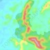
Ladang Sungkap Para

Malaysia > Kedah > Sungai Petani

Average elevation: 45 m

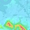
Darulaman Perdana

Malaysia > Kedah > Sungai Petani

Average elevation: 37 m

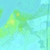
Sungai Layar Hujung

Malaysia > Kedah > Sungai Petani

Average elevation: 4 m

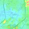
Bandar Mutiara Park

Malaysia > Kedah > Sungai Petani

Average elevation: 33 m

Kampung Pantai Perai

Malaysia > Kedah > Sungai Petani

Average elevation: 13 m

Hutan Rizab Sungkap

Malaysia > Kedah > Sungai Petani

Average elevation: 78 m

Sungai Pasir

Malaysia > Kedah > Sungai Petani

Average elevation: 5 m

Kampung Padang Temusu

Malaysia > Kedah > Sungai Petani

Average elevation: 28 m

Bakar Kapor

Malaysia > Kedah > Sungai Petani

Average elevation: 8 m

Gear up for your next adventure:

⛺Camping Shelters - Emergency and lightweight shelters for outdoor use
🥤Hiking Water Bottles - Reusable bottles for hydration on the trail
🧭Orienteering Compasses - Accurate compasses for map-based navigation
🧊Personal Water Filters - Drink safely from mountain streams marked on your map
🥄Titanium Camping Sporks - The ultimate lightweight utensil for trail meals

As an Amazon Associate, this site earns from qualifying purchases at no extra cost to you.