Geolocate

Surses topographic maps

Click on a map to view its topography, its elevation and its terrain.
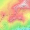
Pass Lunghin

Switzerland > Grisons > Albula/Alvra > Surses

Average elevation: 2,414 m

Gear up for your next adventure:

👖Convertible Hiking Trousers - Versatile zip-off pants for changing mountain weather conditions
💧Hydration Reservoirs - Convenient water bladders for hands-free drinking on the move
🔋Solar Power Banks - Keep your GPS and phone charged during multi-day expeditions
🥤Hydration Bladders - Hands-free hydration systems for backpacks
🎒Multi-day Trekking Packs - Large capacity backpacks for wild camping and long-distance trails

As an Amazon Associate, this site earns from qualifying purchases at no extra cost to you.