Geolocate

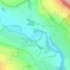
Eggleston topographic maps

Click on a map to view its topography, its elevation and its terrain.

Teesdale

United Kingdom > England > County Durham > Eggleston

Average elevation: 239 m

Gear up for your next adventure:

📦Dry Bags - Waterproof bags to protect gear from rain
📸Action Camera Chest Mounts - Record your ascent following topographic paths hands-free
🧰Survival Kits - Emergency tools for remote environments
🐕Dog Hiking Gear - Equipment for hiking safely with dogs
🥫Expedition Meals - Lightweight, high-calorie nutrition for long-distance hikers

As an Amazon Associate, this site earns from qualifying purchases at no extra cost to you.