Geolocate

Bezirk Schwaz topographic maps

Click on a map to view its topography, its elevation and its terrain.
Finsing

Austria > Tyrol > Bezirk Schwaz

Average elevation: 747 m

Schwaz

Austria > Tyrol > Bezirk Schwaz

Average elevation: 816 m

Zell am Ziller

Austria > Tyrol > Bezirk Schwaz

Average elevation: 744 m

Gagering

Austria > Tyrol > Bezirk Schwaz > Fügen

Average elevation: 722 m

Achensee

Austria > Tyrol > Bezirk Schwaz > Eben am Achensee > Pertisau

Average elevation: 1,340 m

Fügen

Austria > Tyrol > Bezirk Schwaz

Average elevation: 771 m

Hochwartspitze

Austria > Tyrol > Bezirk Schwaz > Tux

Average elevation: 2,182 m

Pertisau

Austria > Tyrol > Bezirk Schwaz > Eben am Achensee

Average elevation: 1,141 m

Mayrhofen

Austria > Tyrol > Bezirk Schwaz

Average elevation: 1,983 m

Gerlos

Austria > Tyrol > Bezirk Schwaz

Gerlos is located in the de:Gerlostal, which is a side valley of the Zillertal, branching to the east near Zell am Ziller. Gerlos consists of several hamulated located along the de:Gerlospass on the floor of the valley, at an altitude of around 1200m. To the south, the side valleys of de:Schwarzach,…

Average elevation: 1,911 m
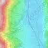
Fügen

Austria > Tyrol > Bezirk Schwaz > Gemeinde Fügen

Average elevation: 737 m

Maurach

Austria > Tyrol > Bezirk Schwaz > Eben am Achensee

Average elevation: 1,197 m

Juns

Austria > Tyrol > Bezirk Schwaz

Average elevation: 1,752 m

Hintertux

Austria > Tyrol > Bezirk Schwaz

Average elevation: 1,949 m

Tux

Austria > Tyrol > Bezirk Schwaz

Average elevation: 2,110 m

Ginzling

Austria > Tyrol > Bezirk Schwaz > Mayrhofen

Average elevation: 1,564 m

Brandberg

Austria > Tyrol > Bezirk Schwaz

Average elevation: 1,922 m

Weer

Austria > Tyrol > Bezirk Schwaz

Average elevation: 622 m

Kumbichl

Austria > Tyrol > Bezirk Schwaz > Mayrhofen

Average elevation: 1,046 m

Pill

Austria > Tyrol > Bezirk Schwaz

Average elevation: 1,065 m

Loach

Austria > Tyrol > Bezirk Schwaz > Ahrnbach

Average elevation: 839 m

Eben am Achensee

Austria > Tyrol > Bezirk Schwaz

Average elevation: 1,401 m

Mitteremberg

Austria > Tyrol > Bezirk Schwaz > Kaltenbach

Average elevation: 928 m

Zillertal

Austria > Tyrol > Bezirk Schwaz > Kaltenbach

Average elevation: 1,499 m

Gemeinde Finkenberg

Austria > Tyrol > Bezirk Schwaz

Average elevation: 2,088 m

Gemeinde Hart im Zillertal

Austria > Tyrol > Bezirk Schwaz

Average elevation: 1,179 m

6280

Austria > Tyrol > Bezirk Schwaz > Rohrberg > Wiesenalm

Average elevation: 1,410 m

About this place

 •  •  •  •  •  •  •

Gear up for your next adventure:

⛺Lightweight Tents - Compact tents for backpacking and trekking
📱Phone Mounts for Hiking - Secure mounts to carry your phone on trails
🛰️Satellite Messengers - Emergency communication devices for areas without mobile signal
🌄Compact Monoculars - Lightweight optics for hiking
🧊Personal Water Filters - Drink safely from mountain streams marked on your map

As an Amazon Associate, this site earns from qualifying purchases at no extra cost to you.