Geolocate

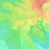
Dibombari topographic map

Click on the map to display elevation.

About this map

Name: Dibombari topographic map, elevation, terrain.

Location: Dibombari, Moungo, Littoral, Cameroon (4.06527 9.41078 4.28518 9.76773)

Average elevation: 26 m

Minimum elevation: -6 m

Maximum elevation: 128 m

Other topographic maps

Click on a map to view its topography, its elevation and its terrain.
Nkongsamba

Cameroon > Littoral > Moungo

Average elevation: 844 m

Békouma

Cameroon > Littoral > Moungo > Dibombari

Average elevation: 35 m

Bassa

Cameroon > Littoral > Moungo > Dibombari

Average elevation: 22 m

Gear up for your next adventure:

🛑Emergency Bivvy Bags - Heat-reflective survival bags for unexpected nights out
🚲Bikepacking Frame Bags - Storage for tools and navigation gear on long off-road rides
🔦Outdoor Torches - Reliable torches for night navigation
🕶️Polarized Sunglasses - Reduces glare from snow and water when reading terrain
🎒Multi-day Trekking Packs - Large capacity backpacks for wild camping and long-distance trails

As an Amazon Associate, this site earns from qualifying purchases at no extra cost to you.