
泾源县 topographic map
Interactive map
Click on the map to display elevation.
About this map
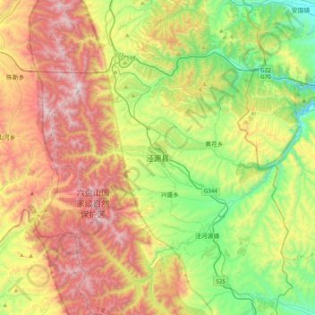
Name: 泾源县 topographic map, elevation, terrain.
Location: 泾源县, 固原市, 宁夏回族自治区, 中国 (35.33047 106.17615 35.65047 106.49615)
Average elevation: 2,100 m
Minimum elevation: 1,507 m
Maximum elevation: 2,917 m
Other topographic maps
Click on a map to view its topography, its elevation and its terrain.