
Zurzach topographic map
Interactive map
Click on the map to display elevation.
About this map
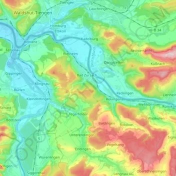
Name: Zurzach topographic map, elevation, terrain.
Location: Zurzach, Bezirk Zurzach, Aargau, 5330, Schweiz (47.54219 8.25223 47.61350 8.42551)
Average elevation: 416 m
Minimum elevation: 311 m
Maximum elevation: 664 m
Other topographic maps
Click on a map to view its topography, its elevation and its terrain.
Hörndli
Schweiz > Aargau > Bezirk Zurzach > Zurzach
Hörndli, Zurzach, Bezirk Zurzach, Aargau, 5330, Schweiz
Average elevation: 402 m
Bad Zurzach
Schweiz > Aargau > Bezirk Zurzach > Zurzach
Bad Zurzach, Zurzach, Bezirk Zurzach, Aargau, 5330, Schweiz
Average elevation: 381 m