
Hörndli topographic map
Interactive map
Click on the map to display elevation.
About this map
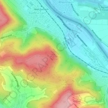
Name: Hörndli topographic map, elevation, terrain.
Location: Hörndli, Zurzach, Bezirk Zurzach, Aargau, 5330, Schweiz (47.57630 8.30020 47.57640 8.30030)
Average elevation: 402 m
Minimum elevation: 320 m
Maximum elevation: 540 m
Other topographic maps
Click on a map to view its topography, its elevation and its terrain.
Zurzach
Schweiz > Aargau > Bezirk Zurzach > Zurzach
Zurzach, Bezirk Zurzach, Aargau, 5330, Schweiz
Average elevation: 416 m
Bad Zurzach
Schweiz > Aargau > Bezirk Zurzach > Zurzach
Bad Zurzach, Zurzach, Bezirk Zurzach, Aargau, 5330, Schweiz
Average elevation: 381 m