
Berea topographic map
Click on the map to display elevation.
About this map
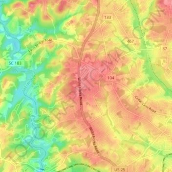
Name: Berea topographic map, elevation, terrain.
Average elevation: 300 m
Minimum elevation: 252 m
Maximum elevation: 331 m
Other topographic maps
Click on a map to view its topography, its elevation and its terrain.
Marietta
United States > South Carolina > Greenville County > Slater-Marietta
Average elevation: 317 m
Isaqueena Park
United States > South Carolina > Greenville County > Greenville
Average elevation: 297 m
Cleveland Forest
United States > South Carolina > Greenville County > Greenville
Average elevation: 287 m
Sherwood Forest
United States > South Carolina > Greenville County > Greenville
Average elevation: 293 m
Sunny Acres
United States > South Carolina > Greenville County > Travelers Rest
Average elevation: 326 m
Mount Vernon Estates
United States > South Carolina > Greenville County > Greer
Average elevation: 302 m
Little Table Rock Mountain
United States > South Carolina > Greenville County
Average elevation: 892 m
Piney Ridge
United States > South Carolina > Greenville County > Wade Hampton
Average elevation: 304 m
Glenwood Acres
United States > South Carolina > Greenville County > Greenville
Average elevation: 305 m
Morningside
United States > South Carolina > Greenville County > Wade Hampton
Average elevation: 300 m
Orchard Acres
United States > South Carolina > Greenville County > Wade Hampton
Average elevation: 292 m
Crescentwood Village
United States > South Carolina > Greenville County > Mauldin
Average elevation: 276 m
Evergreen Place
United States > South Carolina > Greenville County > Greenville
Average elevation: 288 m