Geolocate

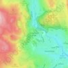
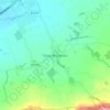
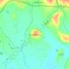
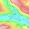
s topographic map

Click on the map to display elevation.

About this map

Name: s topographic map, elevation, terrain.

Location: s, Wold Farm, Heslerton, North Yorkshire, England, United Kingdom (54.15695 -0.60498 54.15751 -0.60418)

Average elevation: 144 m

Minimum elevation: 40 m

Maximum elevation: 192 m

North Yorkshire trails, hiking, mountain biking, running and outdoor activities

Other topographic maps

Click on a map to view its topography, its elevation and its terrain.
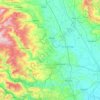
Harrogate

United Kingdom > England > North Yorkshire

Harrogate is situated on the edge of the Yorkshire Dales, with the Vale of York to the east and the upland Yorkshire Dales to the west and north-west. It has a dry and mild climate, typical of places in the rain shadow of the Pennines. It is on the A59 from Skipton to York. At an altitude of between 100 and…

Average elevation: 131 m

Hawes

United Kingdom > England > North Yorkshire

Average elevation: 430 m

Leyburn

United Kingdom > England > North Yorkshire

Average elevation: 195 m

Sinnington

United Kingdom > England > North Yorkshire

Average elevation: 66 m

Hardraw

United Kingdom > England > North Yorkshire > Appersett

Average elevation: 325 m

Bulmer

United Kingdom > England > North Yorkshire

Average elevation: 66 m

Ripon

United Kingdom > England > North Yorkshire

Average elevation: 46 m

Thwaite

United Kingdom > England > North Yorkshire

Average elevation: 417 m

Grassington

United Kingdom > England > North Yorkshire

Average elevation: 310 m

Settle

United Kingdom > England > North Yorkshire

Average elevation: 239 m

Bentham

United Kingdom > England > North Yorkshire > High Bentham

Average elevation: 168 m

Harrogate

United Kingdom > England > North Yorkshire

Harrogate is situated on the edge of the Yorkshire Dales, with the Vale of York to the east and the upland Yorkshire Dales to the west and north-west. It has a dry and mild climate, typical of places in the rain shadow of the Pennines. It is on the A59 from Skipton to York. At an altitude of between 100 and…

Average elevation: 106 m

Stainburn

United Kingdom > England > North Yorkshire

Average elevation: 169 m

Ampleforth

United Kingdom > England > North Yorkshire

Average elevation: 136 m

Masham

United Kingdom > England > North Yorkshire

Average elevation: 107 m

Richmond

United Kingdom > England > North Yorkshire

Average elevation: 166 m

Foxholes

United Kingdom > England > North Yorkshire

Average elevation: 96 m

Ellerbeck

United Kingdom > England > North Yorkshire > Hambleton

Average elevation: 97 m

Feizor

United Kingdom > England > North Yorkshire > Lawkland

Average elevation: 227 m

Finghall

United Kingdom > England > North Yorkshire > Finghall

Average elevation: 117 m

Bewerley

United Kingdom > England > North Yorkshire

Average elevation: 312 m

Low Row

United Kingdom > England > North Yorkshire

Average elevation: 358 m

Skipton

United Kingdom > England > North Yorkshire

Average elevation: 173 m

Coxwold

United Kingdom > England > North Yorkshire

Average elevation: 79 m

Malton

United Kingdom > England > North Yorkshire

As with the rest of the British Isles and Yorkshire, Malton possesses a maritime climate with cool summers and mild winters. The nearest Met Office weather station for which records are available is High Mowthorpe, about 6 miles (10 km) east of the town centre. Due to its lower elevation, the town centre is…

Average elevation: 28 m

Middleham

United Kingdom > England > North Yorkshire

The town lies between 400 and 500 feet (120 and 150 m) above ordnance datum. The valley of the River Ure below the town has an altitude of 325 feet (99 m) and the summit of the hill to the south-west of the town of 850 feet (260 m). The parish contains 2,155 acres (872 ha) of land, mostly permanent pasture…

Average elevation: 157 m

Askrigg

United Kingdom > England > North Yorkshire

Average elevation: 384 m

Marton

United Kingdom > England > North Yorkshire

Average elevation: 37 m

Speeton

United Kingdom > England > North Yorkshire

Average elevation: 71 m

River Esk

United Kingdom > England > North Yorkshire

Average elevation: 189 m

Cononley

United Kingdom > England > North Yorkshire > Cononley

Average elevation: 179 m

Scarborough

United Kingdom > England > North Yorkshire

The climate is temperate with mild summers and cool, windy, winters. The hottest months of the year are July and August, with temperatures reaching an average high of 17 °C and falling to 11 °C at night. The average daytime temperatures in January are 4 °C, falling to 1 °C at night. The station's elevation…

Average elevation: 50 m

South Cowton

United Kingdom > England > North Yorkshire

Average elevation: 49 m

River Nidd

United Kingdom > England > North Yorkshire

Average elevation: 137 m

Rainton

United Kingdom > England > North Yorkshire

Average elevation: 36 m

Pickhill

United Kingdom > England > North Yorkshire

Average elevation: 29 m

Carperby

United Kingdom > England > North Yorkshire

Average elevation: 244 m

Coulton

United Kingdom > England > North Yorkshire

Average elevation: 96 m

Gaping Gill

United Kingdom > England > North Yorkshire

Average elevation: 438 m

Filey

United Kingdom > England > North Yorkshire

For more than 40 years Butlin's Filey Holiday Camp was a major factor in Filey's economy. Building began in 1939 and continued during the Second World War when it became an air force station known as RAF Hunmanby Moor. In 1945 it became a popular holiday resort and a new LNER branch line with station was…

Average elevation: 27 m

Sowerby

United Kingdom > England > North Yorkshire

Average elevation: 31 m

Gargrave

United Kingdom > England > North Yorkshire > Gargrave

Average elevation: 136 m

East Cowton

United Kingdom > England > North Yorkshire

Average elevation: 49 m

Wass

United Kingdom > England > North Yorkshire

Average elevation: 154 m

Crossgates

United Kingdom > England > North Yorkshire

Average elevation: 51 m

North Cowton

United Kingdom > England > North Yorkshire

Average elevation: 57 m

Helperthorpe

United Kingdom > England > North Yorkshire

Average elevation: 111 m

Ebberston

United Kingdom > England > North Yorkshire

Average elevation: 76 m

Welburn

United Kingdom > England > North Yorkshire

Average elevation: 63 m

Thornthwaite

United Kingdom > England > North Yorkshire

Average elevation: 215 m

Horsehouse

United Kingdom > England > North Yorkshire

Horsehouse is a village in Coverdale in the Yorkshire Dales, North Yorkshire, England. It is listed as a hamlet in many texts, but the presence of the church makes it a village. The River Cover runs near the village, and it lies some 6 miles (9.7 km) and 8.5 miles (13.7 km) south-west of Middleham and Leyburn…

Average elevation: 354 m

Lastingham

United Kingdom > England > North Yorkshire

Average elevation: 172 m

Middleton

United Kingdom > England > North Yorkshire

Average elevation: 70 m

Swinton

United Kingdom > England > North Yorkshire

Average elevation: 48 m

Marske

United Kingdom > England > North Yorkshire

Average elevation: 282 m

Selby

United Kingdom > England > North Yorkshire

Average elevation: 7 m

Long Drax

United Kingdom > England > North Yorkshire

Average elevation: 5 m

Hanlith

United Kingdom > England > North Yorkshire

Average elevation: 242 m

Street

United Kingdom > England > North Yorkshire > Glaisdale

Average elevation: 205 m

Leeming

United Kingdom > England > North Yorkshire

Average elevation: 36 m

Sessay

United Kingdom > England > North Yorkshire

Average elevation: 30 m

Westerdale

United Kingdom > England > North Yorkshire

Average elevation: 287 m

Nether Silton

United Kingdom > England > North Yorkshire

Average elevation: 171 m

Whitwell

United Kingdom > England > North Yorkshire

Average elevation: 50 m

Whitwell-on-the-Hill

United Kingdom > England > North Yorkshire

Langdale's 1822 Topographical Dictionary reports "a well of remarkably clear water, from which the town derives its name". The 1828 The New Yorkshire Gazetteer or Topographical Dictionary by Stephen Reynolds Clarke states that Whitwell is "6 miles S.W. from Malton [has] a singular well, the water of which is…

Average elevation: 51 m

Netherby

United Kingdom > England > North Yorkshire > Harrogate

Average elevation: 67 m

Drax

United Kingdom > England > North Yorkshire

Average elevation: 5 m

West Ayton

United Kingdom > England > North Yorkshire

Average elevation: 58 m

Whitley

United Kingdom > England > North Yorkshire

Average elevation: 10 m

Azerley

United Kingdom > England > North Yorkshire

Average elevation: 107 m

Easby

United Kingdom > England > North Yorkshire

Average elevation: 132 m

Redcar

United Kingdom > England > North Yorkshire

Average elevation: 8 m

Kettlewell

United Kingdom > England > North Yorkshire

Average elevation: 342 m

Reeth

United Kingdom > England > North Yorkshire

Average elevation: 295 m

Warsill

United Kingdom > England > North Yorkshire

Average elevation: 211 m

Gear up for your next adventure:

📦Dry Bags - Waterproof bags to protect gear from rain
🧴Tick Removal Tools - Small, essential health tool for UK woodland and moorland
🥤Collapsible Water Bottles - Save space in your rucksack as you consume your water
🥾Men's Waterproof Hiking Boots - Durable footwear with deep lugs for muddy and rocky UK terrains
🍲Portable Camping Stoves - Fast-boiling stoves for hot meals on remote topographic survey trips

As an Amazon Associate, this site earns from qualifying purchases at no extra cost to you.