
Ouse topographic map
Click on the map to display elevation.
About this map
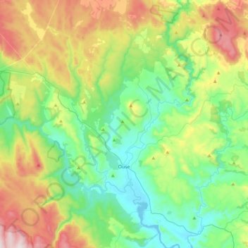
Name: Ouse topographic map, elevation, terrain.
Location: Ouse, Central Highlands, Tasmania, 7140, Australia (-42.57802 146.49324 -42.29314 146.87634)
Average elevation: 382 m
Minimum elevation: 72 m
Maximum elevation: 1,049 m
Other topographic maps
Click on a map to view its topography, its elevation and its terrain.