
Thank you for supporting this site ❤️
Make a donation
Make a donation
Gear up for your next adventure:
As an Amazon Associate, this site earns from qualifying purchases at no extra cost to you.
Igoji topographic map
Click on the map to display elevation.
Thank you for supporting this site ❤️
Make a donation
Make a donation
Gear up for your next adventure:
As an Amazon Associate, this site earns from qualifying purchases at no extra cost to you.
About this map
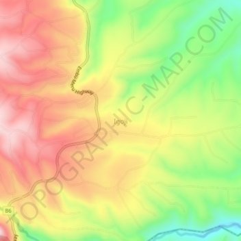
Name: Igoji topographic map, elevation, terrain.
Location: Igoji, Igoji East ward, Imenti South, Meru County, Kenya (-0.20800 37.66085 -0.16800 37.70085)
Average elevation: 1,309 m
Minimum elevation: 1,120 m
Maximum elevation: 1,470 m
Thank you for supporting this site ❤️
Make a donation
Make a donation
Gear up for your next adventure:
As an Amazon Associate, this site earns from qualifying purchases at no extra cost to you.