
Pegeni topographic map
Interactive map
Click on the map to display elevation.
About this map
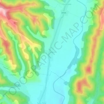
Name: Pegeni topographic map, elevation, terrain.
Location: Pegeni, Hurezani, Gorj, 217262, Roumanie (44.76528 23.61959 44.80528 23.65959)
Average elevation: 267 m
Minimum elevation: 204 m
Maximum elevation: 396 m
Other topographic maps
Click on a map to view its topography, its elevation and its terrain.