Geolocate

Harlem topographic map

Interactive map

Click on the map to display elevation.

About this map

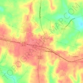
Name: Harlem topographic map, elevation, terrain.

Location: Harlem, Columbia County, Georgia, United States (33.39595 -82.34061 33.44207 -82.28565)

Average elevation: 148 m

Minimum elevation: 104 m

Maximum elevation: 173 m

Other topographic maps

Click on a map to view its topography, its elevation and its terrain.

Leah

United States > Georgia > Columbia County

Leah, Columbia County, Georgia, United States

Average elevation: 124 m

Campania

United States > Georgia > Columbia County

Campania, Columbia County, Georgia, 30814, United States

Average elevation: 147 m

Grovetown

United States > Georgia > Columbia County > Grovetown

Grovetown, Columbia County, Georgia, United States

Average elevation: 134 m