
Ungheni topographic map
Interactive map
Click on the map to display elevation.
About this map
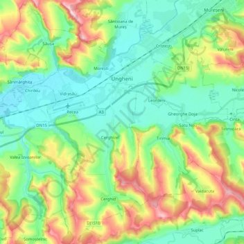
Name: Ungheni topographic map, elevation, terrain.
Location: Ungheni, Zona Metropolitană Târgu Mureș, Mureș, Roménia (46.38859 24.35345 46.52817 24.50267)
Average elevation: 356 m
Minimum elevation: 284 m
Maximum elevation: 507 m
Other topographic maps
Click on a map to view its topography, its elevation and its terrain.