
Pipea topographic map
Interactive map
Click on the map to display elevation.
About this map
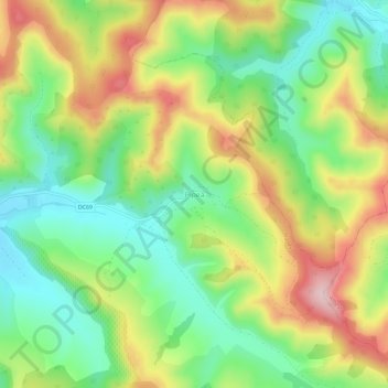
Name: Pipea topographic map, elevation, terrain.
Location: Pipea, Nadeș, Mureș, 547432, Roménia (46.30523 24.75455 46.34523 24.79455)
Average elevation: 475 m
Minimum elevation: 374 m
Maximum elevation: 613 m
Other topographic maps
Click on a map to view its topography, its elevation and its terrain.