
Attapeu topographic map
Interactive map
Click on the map to display elevation.
About this map
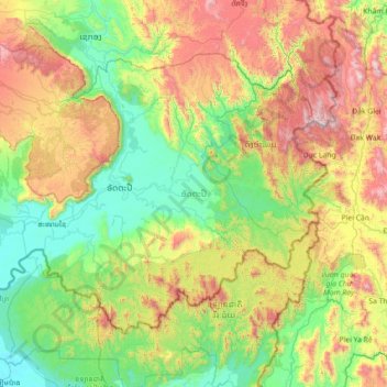
Name: Attapeu topographic map, elevation, terrain.
Location: Attapeu, Laos (14.29232 106.17017 15.28861 107.59147)
Average elevation: 599 m
Minimum elevation: 62 m
Maximum elevation: 1,967 m
Other topographic maps
Click on a map to view its topography, its elevation and its terrain.