
Sanamxay District topographic map
Interactive map
Click on the map to display elevation.
About this map
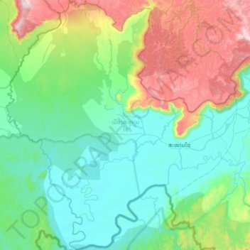
Name: Sanamxay District topographic map, elevation, terrain.
Location: Sanamxay District, Attapeu, Laos (14.44300 106.17017 15.01263 106.71440)
Average elevation: 348 m
Minimum elevation: 65 m
Maximum elevation: 1,273 m
Other topographic maps
Click on a map to view its topography, its elevation and its terrain.