
Paktia Province topographic map
Interactive map
Click on the map to display elevation.
About this map
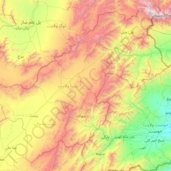
Name: Paktia Province topographic map, elevation, terrain.
Location: Paktia Province, Afghanistan (33.14567 68.76674 34.08644 70.01169)
Average elevation: 2,379 m
Minimum elevation: 1,082 m
Maximum elevation: 4,714 m
Other topographic maps
Click on a map to view its topography, its elevation and its terrain.
Ahmadabad
Ahmadabad, Paktia Province, Afghanistan
Average elevation: 2,810 m