
Ahmadabad topographic map
Interactive map
Click on the map to display elevation.
About this map
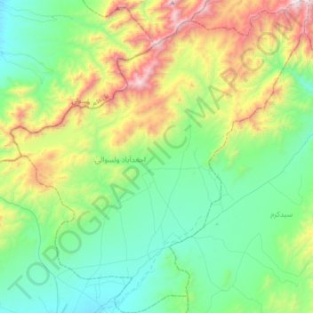
Name: Ahmadabad topographic map, elevation, terrain.
Location: Ahmadabad, Paktia Province, Afghanistan (33.62735 69.18033 33.90992 69.50504)
Average elevation: 2,810 m
Minimum elevation: 2,347 m
Maximum elevation: 4,024 m
Other topographic maps
Click on a map to view its topography, its elevation and its terrain.